Tuesday, 6 August 2013
Climbing The Helm.
I have been meaning to climb to the top of Helm for weeks , but one thing or the other has prevented it. So today the weather being better I set off .


The path leaves the main road and climbs steadily , the Helm has a lot more trees and undergrowth nowadays than when I was a child .

A ruined Victorian (?) summerhouse .

The site of 'The Wishing Tree' , there used to be a oak tree growing behind this wall and as a child we knew it as 'The Wishing Tree' . You had to pick up a small stone and insert it into the wall and then make a wish . Sadly about ten years ago the tree blew down and there seems to be a thorn tree growing in the same position .

People must be still placing small stones in the wall (I did and made a wish !). I find this sort of thing fascinating - how did it start , is it some sort of ancient folk memory ? , I do hope future generations carry it on.

A view of Arnside and part of the River Kent estuary.

First view of the summit , I was climbing from the south approach.

Getting a bit nearer , whilst climbing this steep bit I found it necessary to stop frequently and admire the views.

At last the summit marked by a Trig Point - these have now been made redundant due to satellite technology. The summit is 607 ft above sea level .

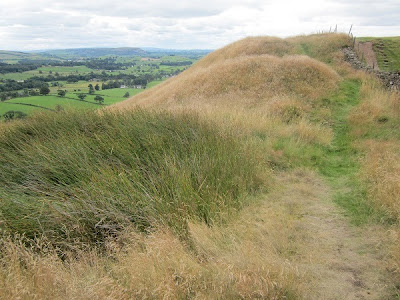
The summit has a Iron Age fort capping it - well that's what books say, there is defiantly something on the top. Another theory is a Roman signal station- as it has fine views to the Lancaster fort and to the fort at Watercrook near Kendal. I don't think there was ever a permanent structure there, as there is no proper water source nearby and the summit is very exposed to the elements . As far as I know there has been no archaeology done on the site, although I believe it has been planned (I must try and find out where the plans are). Too the North side there has been a rampart and ditch dug as this was the most exposed side - the other three sides are very steep . The sheep are on the rampart , which I'm afraid does not show up well in this photo.

A slightly better photo looking South , luckily the sheep have not moved !. The shape of the fortifications can be seen better from this position.

The only source of water , on the archaeological plans I mentioned this area of rushes is described as a manmade trough cut into the rock to gather rainwater . It was holding water today and would have been a limited supply of drinking water.

Home Sweet Home - our village.

Kendal - 'The Auld Grey Town' , with Kentmere Fells and High Street range in the distance.

The view to the South , the River Kent estuary.

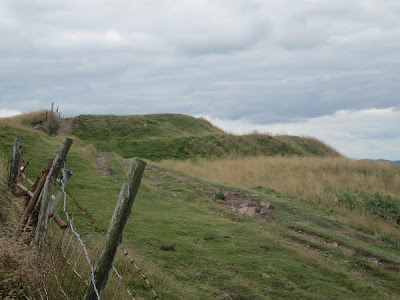
From the summit I headed north , you can see the distinctive manmade shape.

The 'Back of Helm' , as a child you were not allowed this side of the hill , but recently permission has been granted for people to walk on this side and several stiles have been installed , so this is a first venture for me.

Fell Ponies - it's a good job my wife was not with me on this walk - she hates horses !

A small blue flower which I must try and identify.

A final view of the summit .

Even more Fell Ponies .

Helm Tarn - NOT ! this is a manmade pond to provide water for a generator which was built in the 1930s . It is now defunct and provides water for the livestock. I was going to continue along the ridge to the Station Inn but sadly found I had left my money at home ! , so I cut back across and retraced my steps home to a well deserved cup of tea .
A bit of a try out with my camera's video and my tripod to get a 360 degree view from the top . It could be better and the microphone picked up the wind blowing .
No comments:
Post a Comment